Table of Contents
Introduction: Physical Features of India
- Division of Geographic Regions: India is divided into six geographic regions –
- Himalayan Mountain Range,
- Indo-Gangetic Plain or The Northern Plains,
- Peninsular Plateau: contains mountain ranges (Aravalli, Vindhya, and Satpura ranges), ghats (Eastern Ghats and Western Ghats), and plateaus (Malwa Plateau, Chhota Nagpur Plateau, Deccan Plateau, and Kutch Kathiawar plateau),
- Thar Desert,
- Coastal Plains,
- Islands- The Andaman and Nicobar Islands and the Lakshadweep Islands.
Physical Geography of India Map
Will be uploaded soon.
Physical Features of India at a Glance
| Physical Features of India | Key Features | Elevation | Notable Landforms |
|---|---|---|---|
| The Northern Mountains | Includes the Himalayas, Trans-Himalayas, and Eastern Himalayan Hills. | Avg. 6,000 m (Himalayas) | Mount Everest (8,848.86 m), Kanchenjunga (8,586 m) |
| The Northern Plains | Formed by the alluvium deposited by rivers like the Ganga, Brahmaputra, and Indus. | 150-300 m | Indo-Gangetic Plain, Brahmaputra Valley |
| The Peninsular Plateau | The oldest landmass; made up of hard igneous and metamorphic rocks. | 300-900 m | Deccan Plateau, Chota Nagpur Plateau |
| The Indian Desert | Arid region with sand dunes and sparse vegetation. | 150-300 m | Thar Desert, Great Rann of Kutch |
| The Coastal Plains | Narrow coastal strips along the Arabian Sea and the Bay of Bengal. | 0-200 m | Western and Eastern Coastal Plains, Delta regions |
| The Islands | Includes the Andaman and Nicobar Islands and Lakshadweep. | Highest Point -732 m (Saddle Peak, Andamans) | Coral atolls (Lakshadweep), Volcanic islands (Barren) |
Physical Features of India Notes
The Himalayas
Detailed Article: Himalayan Mountain Range
- Geography – Ranges from south to north:
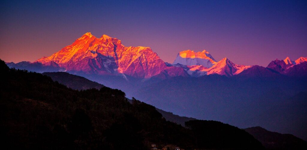
- The Himalayas are composed of four parallel mountain ranges running from south to north.
- Sivalik Hills in the south,
- Middle Himalayas or Himachal,
- The Great Himalayas or Himadri (highest and central range),
- Tibetan Himalayas (the northernmost range).
- The Karakoram range is often regarded as distinct from the Himalayas.
- The width of the Himalayas ranges from 350 km in the west to 150 km in the east.
- The Himalayas are composed of four parallel mountain ranges running from south to north.
- Geographical Extent:
- The Himalayas span over 2400 km from the Nanga Parbat syntaxis in the west to the Namcha Barwa syntaxis in the east.
- Himalayan ranges act as the northern boundary of the Indian subcontinent.
- Formation of The Himalayas:
- These were formed by the ongoing tectonic plates collision of the Indian plates and Eurasian plates.
- The Tethys Sea, which existed between the Indian and Eurasian plates before the collision, left behind layers of sedimentary rocks that were later folded and uplifted to form the Himalayan mountains.
- It is one of the youngest mountain ranges.
- Climatic Impact of Himalayan Mountains:
- The Himalayas act as a barrier to cold polar winds.
- These high mountain ranges act as a barrier to the frigid katabatic winds flowing from Central Asia. Thus, northern India is kept warm or only mildly cooled during winter; in summer, the same phenomenon makes India relatively hot.
- They also facilitate the monsoon winds which in turn influence the climate in India.
- Glaciers:
- The Himalayas, along with the Central Asian Ranges, hold the third-largest ice and snow deposit, after Antarctica and the Arctic.
- This region is sometimes referred to as the “Third Pole” due to its vast ice and snow deposits.
- Notable glaciers in the Himalayas include Siachen, Gangotri and Yamunotri in Uttarakhand, and Zemu in Sikkim.
- Mountain Ranges:
- Pir Panjal Range
- Zanskar Range
- Dhauladhar Range.
- The Siachen Glacier (76 km) in the Karakoram Range is the world’s second-longest glacier outside the polar regions.
- Lambert Glacier (400km) in East Antarctica is the world’s largest glacier.
The Peninsular Plateau
Aravalli Range
- Geographical Extent:
- It is the oldest mountain range in India, running across Rajasthan from northeast to southwest direction, extending approximately 670 km.
- The northern end of the range continues as isolated hills and rocky ridges into Haryana, ending near Delhi.
- Formation: The Aravalli Range is the eroded stub of an ancient fold mountain system.
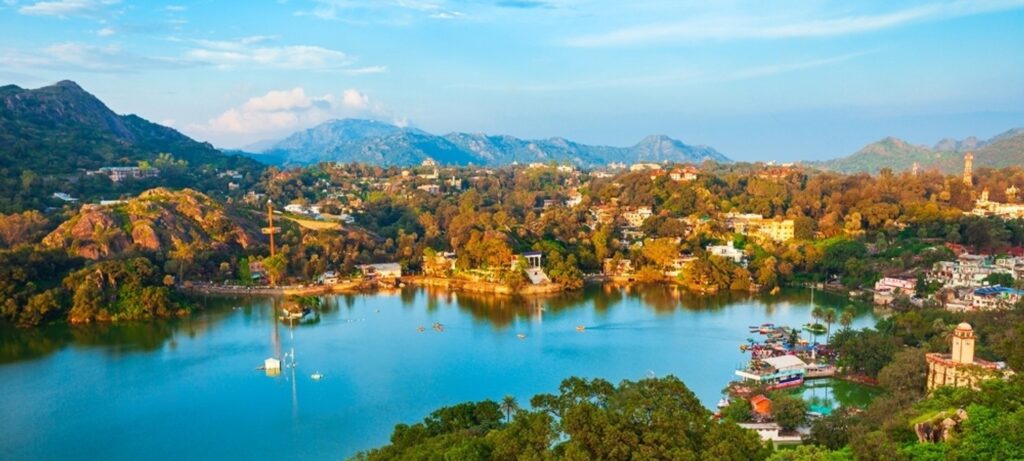
- Highest Peak: The highest peak in this range is Guru Shikhar at Mount Abu, rising to 1,722 m, lying near the border with Gujarat.
Vindhya range
- Vindhya range which lies north of the Satpura range and east of the Aravali range, and runs across most of central India.
- The average elevation of these hills is from 300 to 600 m.
- It separates Northern India from Southern India.
Satpura Range
- Satpura Range lies south of the Vindhya range and east of the Aravali range.
- It starts in eastern Gujarat near the Arabian Sea coast and runs east across Maharashtra, Madhya Pradesh, and Chhattisgarh.
- It runs parallel to the Vindhya Range.
Malwa Plateau
- The average elevation of the Malwa plateau is 500 meters.
- The landscape generally slopes towards the north.
- Most of the region is drained by the Chambal River and its tributaries.
Chhota Nagpur Plateau
- Chhota Nagpur Plateau is situated in eastern India, covering much of Jharkhand and adjacent parts of Odisha, Bihar, and Chhattisgarh.
- It covers an area of approximately 65,000 km2.
Deccan Plateau
- Geographical Overview: The Deccan Plateau, also called Deccan Trapps, is a large triangular plateau.
- Boundaries: It is bounded by the Vindhyas to the north and flanked by the Eastern and Western Ghats.
- Extent of the Deccan Plateau: The Deccan Plateau covers an area of 1.9 million km2.
- Topography and Elevation: It is mostly flat, with elevations ranging from 300 to 600 m (980 to 1,970 ft). The average elevation of the plateau is 2,000 feet (610 m) above sea level. The surface slopes from 3,000 feet (910 m) in the west to 1,500 feet (460 m) in the east.
- Climatic Conditions: This region is mostly semi-arid as it lies on the leeward side of both Ghats.
- Vegetation: Much of the Deccan is covered by thorn scrub forest scattered with small regions of deciduous broadleaf forest.
Kutch Kathiawar plateau
- Kutch Kathiawar plateau is located in Gujarat state.
Indo-Gangetic plain
- The Indo-Gangetic Plain is divided into two drainage basins by the Delhi Ridge.
- the western part consists of the Indus drainage system, and the eastern part consists of the Ganga–Brahmaputra drainage system.
- The Bhabar:-
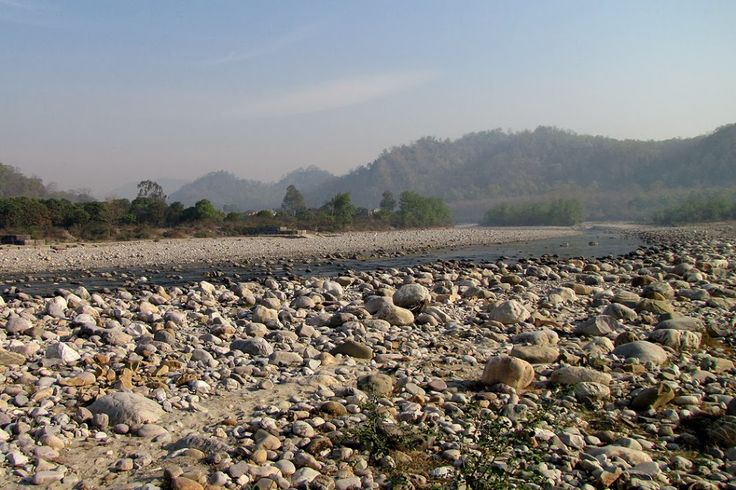
- It is a region of porous ground consisting of boulders and pebbles.
- The river streams disappear here and flow underground.
- Bhabar is a narrow but continuous belt of forest about 8–12 km wide.
- Bhabar is a region south of the Shivalik Hills in the Kumaon Region.
- Below the Bhabar lie the grasslands of Terai and Dooars.
- The Terai or Tarai is a lowland region in northern India and southern Nepal that lies south of the outer foothills of the Himalayas (the Shivalik Hills), and north of the Indo-Gangetic Plain.
- This lowland belt is characterized by tall grasslands, scrub savannahs, sal forests, and clay-rich swamps.
- The region comprises more than 50 wetlands.
- In North India, the Terai spreads from the Yamuna River eastward from Haryana, Uttarakhand, Uttar Pradesh, and Bihar, up to West Bengal.
- The Terai is part of the Terai-Dooars savanna and grasslands ecoregion.
- This lowland region in West Bengal and Assam is called ‘Dooars‘.
- Khadar – It is new alluvium land that is close to the rivers and subject to flooding.
- Bangar – It is the land above the flood limit with older alluvium deposited in the middle Pleistocene Era.
- The soil is rich in silt, making the plain one of the most intensely farmed areas of the world. Even rural areas here are densely populated.
- The plains encompass an area of 700,000 km2 and vary in width through their length by several hundred kilometres.
- The plains are flat and mostly treeless, making it conducive for irrigation through canals.
- The area is also rich in groundwater sources.
Thar Desert
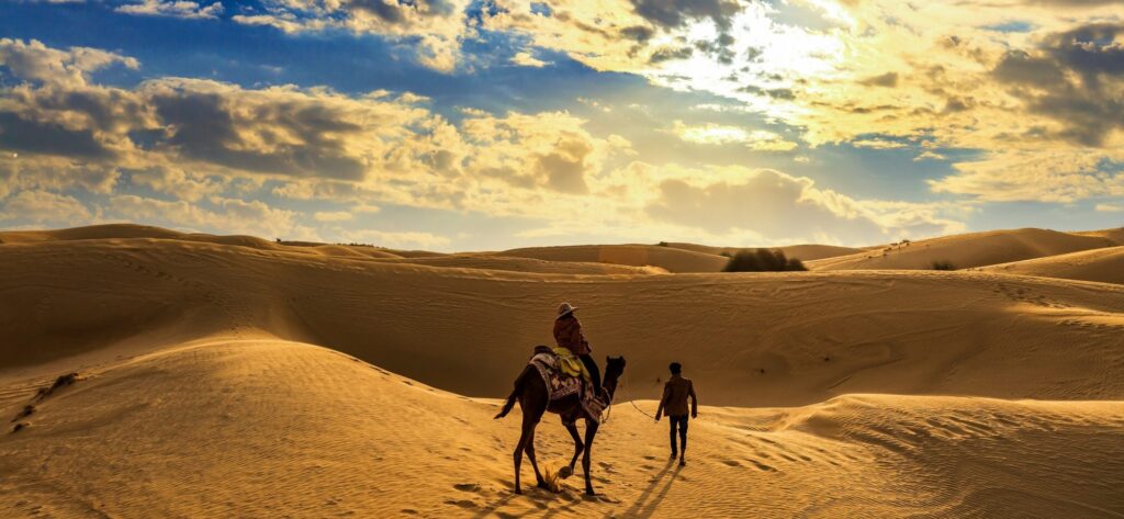
| Area | Around 200,000 km2 (Indian part) About 85% of the Thar Desert is in India 4.56% of the total geographical area of India |
| States within the Desert | More than 60% of the desert lies in Rajasthan also extends into Gujarat, Punjab, and Haryana. |
| Rivers | Luni River Source – Pushkar Valley near Ajmer Mouth – Rann of Kutch in Gujarat |
| Lakes | Sambhar, Kuchaman, Didwana, Pachpadra, and Phalodi (Rajasthan) Kharaghoda (Gujarat) |
| Protected areas within the Desert | Desert National Park (3162 km²) Tal Chhapar Sanctuary (known for blackbucks) |
| Cities located in the desert | Bikaner, Jaisalmer |
Coastal plains
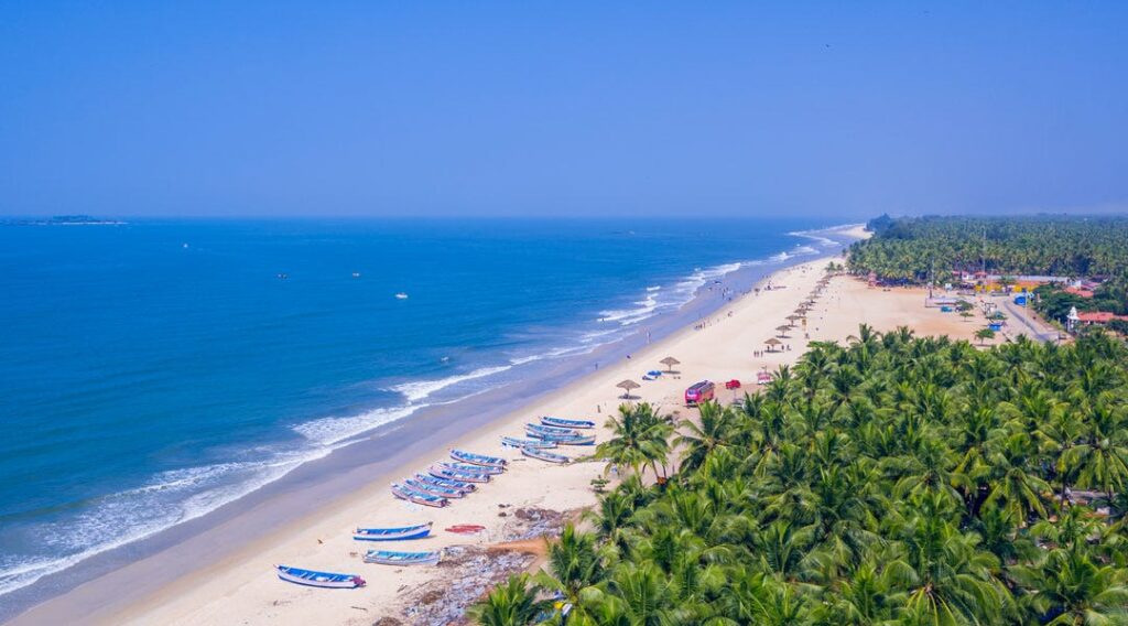
- Formation: These plains have been formed by the deposition of sediments brought down by various rivers, primarily the Ganges, Brahmaputra, Godavari, Krishna, and Kaveri, which flow into the Bay of Bengal and the Arabian Sea.
- Flat Terrain: The coastal plains are generally low-lying and flat, with altitudes rarely exceeding 100 meters above sea level.
- Rich Agricultural Land: The coastal plains support extensive agriculture, with crops like rice, sugarcane, coconuts, spices, and various fruits.
- Biodiversity: The coastal plains harbour diverse ecosystems, including mangrove forests, estuaries, and wetlands.
- Tourism: With their scenic beaches, historical sites, and cultural attractions, the coastal plains of India are major tourist destinations.
- Vulnerability to Natural Disasters: The coastal plains are also prone to natural disasters such as cyclones, floods, and erosion.
Coastline of States
| Total coastline | 7516.6 km Mainland: 5422.6 km Island: 2094 km |
| Gujarat | 1,600 km The longest coastline among the Indian States (24% of the Indian sea coast) |
| Maharashtra | 840 km |
| Goa | 160 km |
| Karnataka | 320 km |
| Kerala | 590 km |
| Tamilnadu | 906.9 km |
| Andhra Pradesh | 974 km |
| Odisha | 485 km |
| West Bengal | 65.5 km (Only East Medinipur district) |
West Coast of India
- The Western Coastal Plain is a narrow strip of land between the Western Ghats and the Arabian Sea. It ranges from 50 to 100 km in width.
- The Western Coastal Plain can be divided into two parts, the Konkan and the Malabar Coast.
Certainly! Here’s the information about Kutch and Kathiawar, Gujarat Plain, Konkan Plain, Karnataka Coastal Plain, and Kerala Plain in table format:
| Region | Key Features | Area (Approx.) | Elevation |
|---|---|---|---|
| Kutch and Kathiawar | Arid region with salt flats, marshlands, and coastal areas. | 45,000 sq. km | 0-300 m |
| Gujarat Plain | Alluvial plain formed by rivers like Sabarmati, Mahi, and Narmada. | 1,20,000 sq. km | 0-100 m |
| Konkan Plain | Narrow coastal strip along the Arabian Sea, characterized by hilly terrain and beaches. | 30,000 sq. km | 0-200 m |
| Karnataka Coastal Plain | Coastal strip between the Western Ghats and the Arabian Sea, known for its beaches and rivers. | 10,000 sq. km | 0-100 m |
| Kerala Plain | Also known as the Malabar Coast, characterized by a network of lagoons, backwaters, and coastal sandbars. | 38,000 sq. km | 0-100 m |
East Coast of India
| Region | Key Features | Notable Landforms |
|---|---|---|
| Utkal Plain (Odisha) | River deltas, fertile alluvial soils, and mangroves in the delta regions | Chilika Lake, Bhitarkanika Mangroves |
| Andhra Plain | A broad coastal plain along the eastern coast, formed by rivers like the Godavari and Krishna. | River deltas, fertile alluvial soils, mangroves in the delta regions |
| Tamil Nadu Plain | Coastal plain along the Bay of Bengal, characterized by river deltas and fertile agricultural land. | Cauvery Delta, Coromandel Coast, coastal dunes |
- The width of the plains varies between 100 and 130 km.
Islands
Physical Features of India PDF
Will be uploaded soon.
Geographic regions of India UPSC PSC MCQs
The Himalayas are formed of parallel fold ranges, of which the oldest range is [IAS (Pre) 1994]
(a) The Shivalik Range
(b) The Lesser Himalayas
(c) The Great Himalayas Range
(d) The Dhauladhar Range
Correct answer: (c) The Great Himalayas Range
How many structural ranges are there in the Himalayas?
[IAS (Pre) 1994]
(a) Three
(b) Four
(c) Five
(d) Seven
Correct answer: (b) Four
Nanda Devi peak is part of which region?
[IAS (Pre) 2003]
(a) Assam Himalayas
(b) Garhwal Himalayas
(c) Nepal Himalayas
(d) Punjab Himalayas
Correct answer: (b) Garhwal Himalayas
Where is Nanda Devi located?
[JPSC (Pre) 2013]
(a) Himachal Pradesh
(b) Uttarakhand
(c) Nepal
(d) Sikkim
Correct answer: (b) Uttarakhand
In which part of the Himalayas is ‘Karewa’ landform found?
[MPPSC (Pre) 2020]
(a) North-East Himalaya
(b) Eastern Himalaya
(c) Himachal-Uttarakhand Himalaya
(d) Kashmir Himalaya
Correct answer: (d) Kashmir Himalaya
The foothills of the Himalayas are known as?
[BPSC (Pre) 1999]
(a) Trans-Himalayas
(b) Shivalik
(c) Great Himalayas
(d) Aravali
Correct answer: (b) Shivalik
The Shivalik series was formed in which geological era?
[BPSC (Pre) 1997]
(a) Eozoic
(b) Paleozoic
(c) Mesozoic
(d) Cenozoic
Correct answer: (d) Cenozoic
What is the main resource of the Western Himalayan region?
[RAS/RTS (Pre) 2010]
(a) Forests
(b) Metallic minerals
(c) Carbonic minerals
(d) Atomic minerals
Correct answer: (a) Forests
In which part of the Himalayas is ‘The Banihal Pass’ located?
[IAS (Pre)]
(a) North-East Himalaya
(b) Eastern Himalaya
(c) Himachal-Uttarakhand Himalaya
(d) Kashmir Himalaya
Correct answer: (d) Kashmir Himalaya
Where is Mount Everest located?
[MPPSC (Pre) 1995]
(a) Pakistan
(b) India
(c) Tibet
(d) Nepal
Correct answer: (d) Nepal
The highest mountain peak in India is?
[BPSC (Pre) 1997]
(a) K2 Godwin Austin
(b) Kanchenjunga
(c) Nanda Devi
(d) Mount Everest
Correct answer: (a) K2 Godwin Austin
In which of the following states are the Himalayan mountain ranges not present?
[MPPSC (Pre) 2012]
(a) Uttarakhand
(b) Uttar Pradesh
(c) Sikkim
(d) Himachal Pradesh
Correct answer: (b) Uttar Pradesh
The hill range separating Manipur from Nagaland is called?
[CDS 2009]
(a) Arakan hill range
(b) Patkai hill range
(c) Barail hill range
(d) Manipur hill range
Correct answer: (c) Barail hill range
The Atal Tunnel is located across which Himalayan range?
[IAS (Pre)]
(a) Zanskar
(b) Western Pir Panjal
(c) Ladakh
(d) Eastern Pir Panjal
Correct answer: (d) Eastern Pir Panjal
Which range does Manasarovar Lake lie in?
[WBCS 2019]
(a) Karakoram range
(b) Pir Panjal range
(c) Kailash range
(d) Mahabharata range
Correct answer: (c) Kailash range
Which region is called the Granary of South India?
[WBCS 2020]
(a) Madras
(b) Thanjavur
(c) Kanyakumari
(d) Coromandel Coast
Correct answer: (b) Thanjavur
Which of the following statements about the Himalayas is not correct?
[Astt. Comm. 2017]
(a) They are young fold mountains.
(b) They have geosynclinal rocks.
(c) The Himalayan Frontal Fault (HFF) separates the Himalayas from Tibet.
(d) Indus and Sutlej rivers form antecedent drainage in the Himalayas.
Correct answer: (c) Himalayan Frontal Fault (HFF) separates Himalaya from Tibet
What is the correct order of Himalayan ranges from North to South?
[Astt. Comm. 2019]
(a) Karakoram, Ladakh, Zaskar, Pir Panjal, Shivalik
(b) Ladakh, Zaskar, Pir Panjal, Karakoram, Shivalik
(c) Pir Panjal, Zaskar, Karakoram, Ladakh, Shivalik
(d) Shivalik, Zaskar, Pir Panjal, Ladakh, Karakoram
Correct answer: (a) Karakoram, Ladakh, Zaskar, Pir Panjal, Shivalik
Which one of the following is the correct northward sequence of the relief features?
[RAS/RTS (Pre) 2013]
(a) Zaskar Range, Pir Panjal Range, Ladakh Range, Karakoram Range
(b) Pir Panjal Range, Zaskar Range, Ladakh Range, Karakoram Range
(c) Karakoram Range, Ladakh Range, Zaskar Range, Pir Panjal Range
(d) Pir Panjal Range, Ladakh Range, Zaskar Range, Karakoram Range
Correct answer: (d) Pir Panjal Range, Ladakh Range, Zaskar Range, Karakoram Range
Consider the following statements. I. In India, the Himalayas are spread over five states only. II. Western Ghats are spread over five states only. III. Pulicat Lake is spread over two states only. Which of the statements given above is/are correct?
[IAS (Pre) 2017]
(a) I and II
(b) Only III
(c) II and III
(d) I and III
Correct answer: (b) Only III
With reference to the Himalayan range, which of the statements is/are correct?
[UPPSC (Pre) 2019]
I. The sedimentary rocks of the Greater Himalayas were fossil-less.
II. Marine living fossils are found in the sedimentary rocks of the Lesser Himalayas.
III. Remains of human civilization are found in the Outer or Shivalik Himalayas.
Select the correct answer using the codes given below.
(a) I and II only
(b) II and III only
(c) I and III only
(d) I, II and III are correct
Correct answer: (a) I and II only
26. If there were no Himalayan ranges, what would have been the most likely geographical impact on India? I. Most of the country would experience the cold waves from Siberia. II. Indo-Gangetic plain would be devoid of such extensive alluvial soils. III. The pattern of monsoon would be different from what it is at present. Which of the statements given above is/are correct?
[IAS (Pre) 2010]
(a) Only I
(b) I and III only
(c) II and III only
(d) I, II and III only
Correct answer: (d) I, II and III only
Given below are two statements, one is labelled as Assertion (A) and the other as Reason (R). Assertion (A): The highest concentration of seismic zones lies in the Himalayan regions of India. Reason (R): There are many longitudinal thrust zones in Himalayas. Which of the following codes is correct?
[UPPSC (Pre) 2019]
(a) Both A and R are true and R is the correct explanation of A
(b) Both A and R are true, but R is not the correct explanation of A
(c) A is true, but R is false
(d) A is false, but R is true
Correct answer: (a) Both A and R are true and R is the correct explanation of A
Siachen Glacier is situated on the?
[IAS (Pre) 2020]
(a) East of Aksai Chin
(b) East of Leh
(c) North of Gilgit
(d) North of Nubra Valley
Correct answer: (d) North of Nubra Valley
34. The rate of melting of Himalayan glaciers is?
[UKPSC (Pre) 2006]
(a) Lowest in the world.
(b) Highest in the world.
(c) Same as the glaciers of other parts of the world.
(d) No information is available about the melting rate of Himalayan glaciers.
Correct answer: (b) Highest in the world.
The Valley of Kashmir is situated between?
[UPPSC 2020, MPPSC 2016]
(a) Kangara and Dhauladhar Ranges.
(b) Pir Panjal and Himadri Ranges.
(c) Mahabharat and Dhauladhar Ranges.
(d) Pir Panjal and Mahabharat Ranges.
Correct answer: (b) Pir Panjal and Himadri Ranges.
The Kullu Valley is situated between the mountain ranges of?
[UPPSC (Pre) 1999]
(a) Dhauladhar and Pir Panjal
(b) Ranjoti and Nagtibba
(c) Ladakh and Pir Panjal
(d) Middle Himalayas and Shivalik
Correct answer: (a) Dhauladhar and Pir Panjal
In which state is ‘Silent Valley’ located in India?
[CGPSC (Pre) 2019]
(a) Tamil Nadu
(b) Kerala
(c) Karnataka
(d) Assam
Correct answer: (b) Kerala
Chumbi Valley is on the boundary of? [WBCS 2020]
(a) Sikkim – Bhutan
(b) Nepal – Sikkim
(c) Bihar – Nepal
(d) Assam – Bangladesh
Correct answer: (a) Sikkim – Bhutan

