Table of Contents
Classification of Major Rivers of India
- The major rivers of India can be classified based on various criteria, including their geographical location, length, and the regions they flow through.
- Here’s a classification of major rivers in India:
- Himalayan Rivers:
- These rivers originate from the Himalayan mountain range and flow through the northern and northeastern regions of India.
- Examples: Ganges, Yamuna, Brahmaputra, Indus, Sutlej, Beas, Ravi, Chenab.
- Peninsular Rivers:
- These rivers originate from the Peninsular Plateau and flow towards the east or west into the Bay of Bengal or the Arabian Sea.
- Examples: Godavari, Krishna, Narmada, Tapti, Mahanadi, Kaveri.
- West Coast Rivers:
- Rivers that flow along the western coast of India and drain into the Arabian Sea.
- Examples: Tapti, Narmada.
- East Coast Rivers:
- Rivers that flow along the eastern coast of India and drain into the Bay of Bengal.
- Examples: Mahanadi, Godavari, Krishna, Kaveri.
- Perennial Rivers:
- Rivers that flow throughout the year, sustaining a consistent water flow.
- Examples: Ganges, Brahmaputra, Godavari, Krishna, Narmada, Kaveri.
- Seasonal Rivers:
- Rivers that experience seasonal variations in flow, depending on monsoon rainfall.
- Examples: Yamuna, Mahanadi, Tapti.
- Transboundary Rivers:
- Rivers that flow across international borders, affecting multiple countries.
- Examples: Indus (flows through India and Pakistan), Brahmaputra (flows through India, China, and Bangladesh).
- Cultural and Historical Significance:
- Rivers renowned for their cultural and historical importance in Indian civilization.
- Examples: Ganges (considered sacred in Hinduism), Yamuna (associated with various legends and historical sites).
- About 77% of the drainage is discharged into the Bay of Bengal while 23% discharges its water into the Arabian Sea.
Major Rivers of India
Ganga
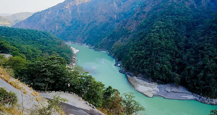
- Origin:
- The Ganga River originates from the Gangotri Glacier in the Himalayas, located in the state of Uttarakhand.
- The upper phase of the river Ganges begins at the confluence of the Bhagirathi and Alaknanda rivers in Devprayag in the Garhwal division of Uttarakhand.
- Course: The Ganges joins the River Yamuna at the Triveni Sangam at Prayagraj (earlier known as Allahabad). The River flows southeast through the northern plains of India. Along its course, it is joined by various tributaries, including the Yamuna, Ghaghara, and Gandak rivers. It enters West Bengal near Farraka and empties into the Bay of Bengal through the Sundarbans delta.
- Tributaries: Yamuna, Ghaghara, Gandak, Kosi.
- Mouth: The River empties into the Bay of Bengal in the Sundarbans Delta, forming the largest river deltas (Sundarban Delta) in the world.
- Cities on the Bank: Several major cities are situated on the banks of the Ganga River, including Haridwar, Kanpur, Prayagraj (Allahabad), Varanasi, Patna, and Kolkata.
- The Ganges-Brahmaputra-Meghna system is the second-largest river on earth by discharge (The First is the Amazon river in South America).
- Dams: Tehri Dam, Bhimgoda Barrage, and Farakka Barrage.
- River Projects: The Ganga Action Plan and Namami Gange are notable river conservation projects aimed at cleaning and rejuvenating the Ganga River. These initiatives focus on reducing pollution, conserving biodiversity, and improving the overall health of the river ecosystem.
- Fauna: The Ganges River dolphin, also known as the South Asian river dolphin (Freshwater Dolphin), is found in the Ganga and its tributaries.
- Inland Waterways: National Waterway 1 (NW1) is an inland waterway that runs along the Ganga-Bhagirathi-Hooghly river system. It stretches from Allahabad in Uttar Pradesh to Haldia in West Bengal, covering a distance of approximately 1,620 kms.
The Indus: Cradle of Civilization
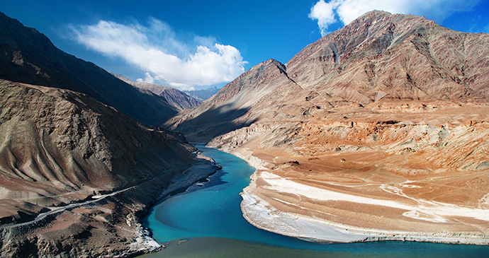
- Source: The Indus (3,120 km) river rises in mountain springs northeast of Mount Kailash in Western Tibet.
- Course: It flows northwest through Kashmir, bends sharply to the left after the Nanga Parbat massif, flows southwest through regions of Ladakh and Gilgit-Baltistan (POK) enters Pakistan and falls into the Arabian Sea near the city of Karachi.
- Mouth: Arabian Sea, southern Pakistan.
- Tributary:
- Its left-bank tributary in Ladakh is the Zanskar River, and its left-bank tributary in the plains is the Panjnad River (combined flow of the Chenab, Jhelum, Ravi, Beas, and Sutlej rivers).
- Its principal right-bank tributaries are the Shyok, Gilgit, Kabul, Kurram, and Gomal rivers.
- Cities on the Bank: Leh, Skardu (POK).
Bramhaputra
- The River: The Brahmaputra is a transboundary river. A transboundary river crosses at least one political border, either a border within a state or an international border.
- Source: It originated in the Manasarovar Lake region, near Mount Kailash, on the northern side of the Himalayas in Burang County of Tibet.
- Alternate Names: It is also known as the Yarlung Tsangpo in Tibet, the Siang/Dihang River in Arunachal Pradesh, and the Jamuna River in Bangladesh.
- Course: It is fed by various glacial meltwaters and small tributaries as it flows through the Tibetan Plateau. It traverses through the eastern Himalayas, forming the world’s deepest canyon, the Yarlung Tsangpo Grand Canyon. It enters India near the village of Gelling in Arunachal Pradesh and flows southwest through the Assam Valley as the Brahmaputra and south through Bangladesh as the Jamuna. It merges with the Ganga, known as the Padma in Bangladesh, and becomes the Meghna. It forms the world’s largest delta, the Sundarbans Delta, before emptying into the Bay of Bengal.
- It is the 9th largest river in the world by discharge and the 15th longest.
- It is also one of the few rivers in the world that exhibits a tidal bore.
- In Assam, the Brahmaputra River Valley created fertile plains ideal for tea cultivation. These fertile plains along the Brahmaputra River support a diverse range of plant species, including tropical evergreen forests, deciduous forests, and wetlands.
- Tributaries:
- Dibang, Lohit, and Subansiri rivers in India
- In Tibet, major tributaries include the Nyang River and the Lhasa River.
- In Bangladesh, the Teesta River is one of the largest tributaries that join the Brahmaputra.
- Inland Waterways: National Waterway 2 (NW-2)(891 kms) runs along the Brahmaputra River from Dhubri to Sadiya in Assam.
Narmada River
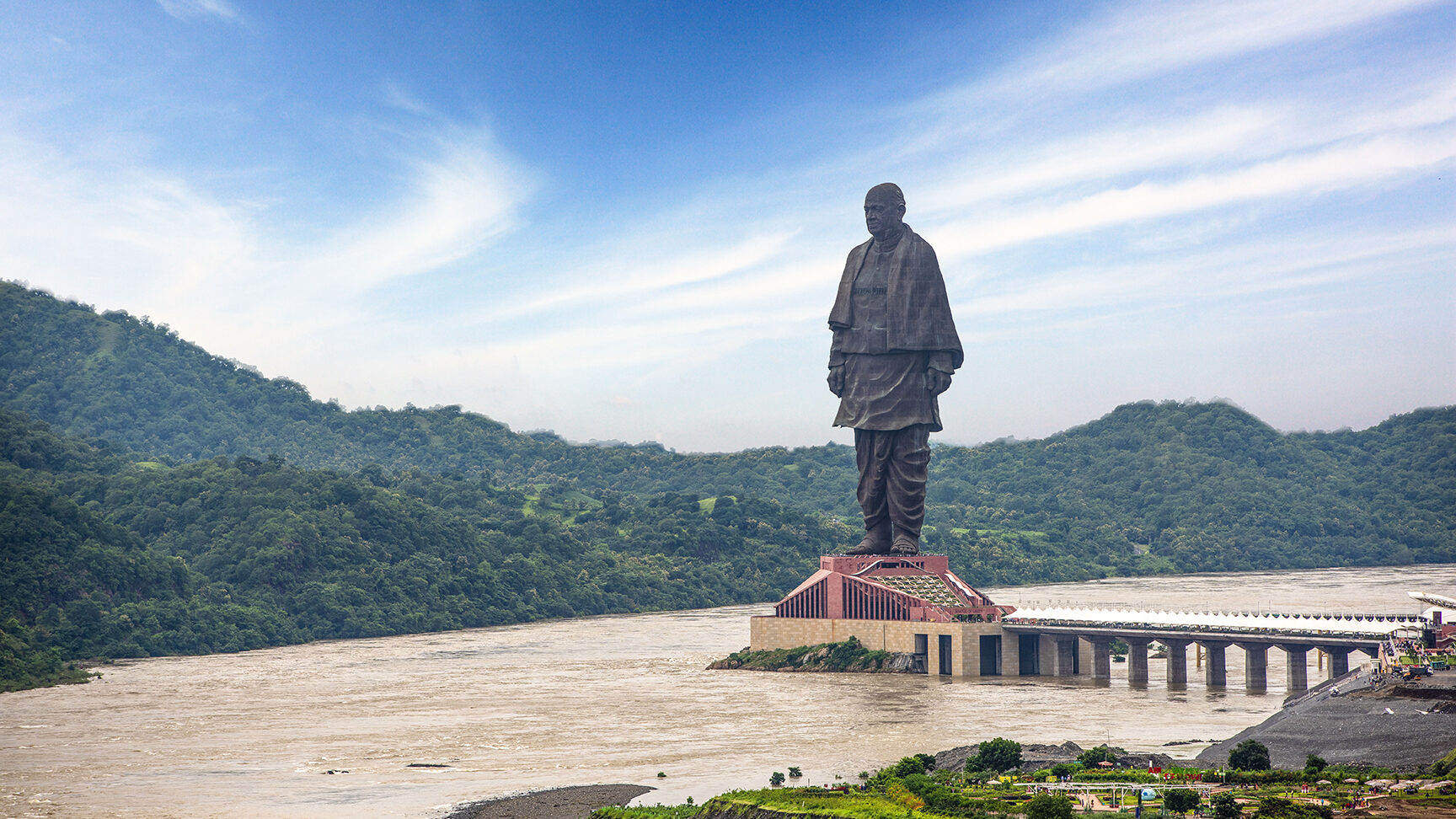
- Source: Originating from the Maikal Range in Madhya Pradesh, it flows through Madhya Pradesh, Maharashtra, and Gujarat, covering a distance of approximately 1,312 km.
- Cultural Importance: Several temples and pilgrimage sites along its banks, including Omkareshwar, Maheshwar, and Narmada Kund.
- Hydroelectric Projects:
- Sardar Sarovar Dam,
- Indira Sagar Dam, and
- Maheshwar Dam.
Godavari
- Origin: The Godavari River originates near Trimbak in the Nashik district of Maharashtra, from the Brahmagiri Mountain in the Western Ghats.
- Tributaries: Pravara, Purna, Manjira, Indravati, and Sabari rivers.
- Course: The River flows eastward through states like Maharashtra, Telangana, and Andhra Pradesh, and empties into the Bay of Bengal.
- Mouth: Bay of Bengal, formed a large delta in Andhra Pradesh.
- Cities on the Bank: Nashik, Nanded, Rajahmundry.
- Dams: Jayakwadi Dam, Sriram Sagar Dam, and Polavaram Dam.
- River Projects: The Polavaram Project is one of the major river projects on the Godavari River. It aims to provide irrigation water to drought-prone areas, generate hydroelectric power, and control floods.
- Fauna: endangered and endemic Godavari mahseer (A cyprinid – stomachless fish with toothless jaws)
- Inland Waterways: National Waterway 4 (NW-4) passes through the eastern part of Godavari River and its deltaic regions.
Kaveri River
- Source: The Kaveri River originates in the Western Ghats at Talakaveri in the Brahmagiri Hills in the state of Karnataka.
- Course: The River flows southeast through towns like Mysore, and enters Tamil Nadu, forming the fertile Kaveri Delta before emptying into the Bay of Bengal.
- Mouth: The Kaveri River empties into the Bay of Bengal, forming the vast and fertile delta region in the state of Tamil Nadu.
- Tributaries: Kabini River, Hemavati River, Shimsha River, Arkavathi River, and Lakshmana Tirtha River.
- Cities on the Banks: Talakaveri, Mysore, Srirangapatna, Shivanasamudra, and Thanjavur.
- Dams: Krishna Raja Sagara Dam and the Mettur Dam.
- Waterfalls: Shivanasamudra Falls.
- River Projects: Various projects have been undertaken to manage the waters of the Cauvery River effectively. The Cauvery River Water Disputes Tribunal, formed in 1990, has been instrumental in resolving disputes between the states of Karnataka, Tamil Nadu, Kerala, and Puducherry regarding the sharing of Cauvery waters.
Krishna River
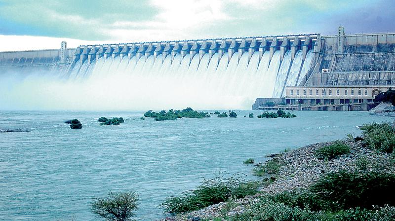
- Origin: The Krishna River originates near Mahabaleshwar in the Satara district of Maharashtra from the Western Ghats.
- Tributaries: Bhima, Tungabhadra, Ghataprabha, Malaprabha, and Musi rivers.
- Course: The river flows southeastward through Maharashtra, Karnataka, and Andhra Pradesh before emptying into the Bay of Bengal.
- Mouth: Bay of Bengal, forming a large delta in Andhra Pradesh.
- Cities on the Bank: Sangli, Vijayawada.
- Dams: Srisailam Dam, Nagarjuna Sagar Dam, Almatti Dam.
- River Projects: The Nagarjuna Sagar Project is a significant irrigation project on the Krishna River, providing water for irrigation and hydroelectric power.
- Fauna: Freshwater turtles.
- Inland Waterways: National Waterway 4 (NW-4) also includes parts of the Krishna River.
Tungabhadra River
- Origin: The Tungabhadra River originates in the Western Ghats, near the town of Koodli in Karnataka, from the confluence of the Tunga and Bhadra rivers.
- Tributaries: Varada, Handri, Vedavati.
- Course: It flows eastward through Karnataka and Andhra Pradesh before joining the Krishna River.
- Mouth: Confluences with the Krishna River near Sangameshwaram in Andhra Pradesh.
- Cities on the Bank: Hospet, Hampi, Kurnool.
- Dams: Tungabhadra Dam.
- River Projects: The Tungabhadra Dam provides irrigation and hydroelectric power to surrounding regions.
- Fauna: Rich in freshwater fish, including several species of mahseer.
- Inland Waterways: Part of inland navigation and irrigation systems in Karnataka and Andhra Pradesh.
Teesta River
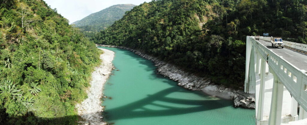
- Origin: The Teesta River originates from the Pahunri (or Teesta Kangse) glacier in the Eastern Himalayas, Sikkim.
- Tributaries: Rangeet River.
- Course: The river flows southward through Sikkim, West Bengal, and Bangladesh, joining the Brahmaputra River in Bangladesh.
- Mouth: Confluences with the Brahmaputra River.
- Cities on the Bank: Kalimpong, Jalpaiguri.
- Dams: Teesta Barrage, Teesta V Dam.
- River Projects: The Teesta Barrage Project is a major irrigation and flood control initiative.
- Fauna: Home to species like the Teesta Mahseer and several migratory birds.
- Inland Waterways: Potential inland waterways are being explored in the lower reaches, especially in Bangladesh.
Mahanadi River
- Origin: The Mahanadi River originates near Sihawa in the Dhamtari district of Chhattisgarh, from the hills of the Eastern Ghats.
- Tributaries: Seonath, Hasdeo, Mand, Ib, and Tel rivers.
- Course: It flows eastward through Chhattisgarh and Odisha, emptying into the Bay of Bengal.
- Mouth: Bay of Bengal, forming a large delta in Odisha.
- Cities on the Bank: Sambalpur, Cuttack.
- Dams: Hirakud Dam, one of the longest earthen dams in the world.
- River Projects: The Hirakud Dam Project provides irrigation, flood control, and hydroelectric power.
- Fauna: Supports a variety of fish species, including catfish and carps, and is a vital habitat for migratory birds.
- Inland Waterways: National Waterway 5 (NW-5) includes parts of the Mahanadi River and its delta.
Tapi River
- Origin: The Tapi River originates in the Satpura Range, near Multai in the Betul district of Madhya Pradesh.
- Tributaries: Purna, Girna, Panjhra, Waghur.
- Course: It flows westward through Madhya Pradesh, Maharashtra, and Gujarat before emptying into the Arabian Sea.
- Mouth: Arabian Sea, near Surat in Gujarat.
- Cities on the Bank: Surat, Burhanpur.
- Dams: Ukai Dam.
- River Projects: The Ukai Dam Project is a major multipurpose project for irrigation, flood control, and power generation.
- Fauna: Rich in fish diversity, including hilsa and several carp species.
- Inland Waterways: The Tapi River has potential for inland navigation, especially near its mouth.
Mahananda River
- Origin: The Mahananda River originates from the Himalayas in Darjeeling district, West Bengal.
- Tributaries: Balason, Mechi.
- Course: It flows southward through West Bengal and Bihar before joining the Ganges in Bangladesh.
- Mouth: Confluences with the Ganges River in Bangladesh.
- Cities on the Bank: Siliguri, Malda.
- Dams: No major dams on the Mahananda, but it has several smaller irrigation projects.
- River Projects: Primarily used for irrigation in its lower course.
- Fauna: The river supports local fish species and is an important source of water for agriculture.
- Inland Waterways: Potential for small-scale inland navigation, especially in the lower reaches.
Kosi River
- Origin: The Kosi River originates from the high Himalayas in Tibet, near Mount Everest.
- Tributaries: Sun Kosi, Arun Kosi, Tamur Kosi.
- Course: It flows through Nepal and Bihar, India, before joining the Ganges.
- Mouth: Confluences with the Ganges River near Kursela, Bihar.
- Cities on the Bank: Saharsa, Purnia.
- Dams: Kosi Barrage.
- River Projects: The Kosi Barrage is a major flood control and irrigation project in Bihar.
- Fauna: Supports a variety of fish and bird species, especially in the wetland areas.
- Inland Waterways: Limited potential due to frequent flooding and sedimentation.
Yamuna River
- Origin: The Yamuna River originates from the Yamunotri Glacier in the Uttarkashi district of Uttarakhand.
- Tributaries: Tons, Chambal, Hindon, Betwa, Ken.
- Course: It flows southward through Uttarakhand, Haryana, Delhi, and Uttar Pradesh, joining the Ganges at Prayagraj.
- Mouth: Confluences with the Ganges River at Prayagraj, Uttar Pradesh.
- Cities on the Bank: Delhi, Agra, Mathura.
- Dams: Hathni Kund Barrage, Okhla Barrage.
- River Projects: The Yamuna Action Plan aims to clean and restore the river’s health.
- Fauna: Habitat for the endangered Ganges river dolphin and several fish species.
- Inland Waterways: National Waterway 110 (NW-110) includes parts of the Yamuna River.
Sutlej River
- Origin: The Sutlej River originates from Lake Rakshastal in Tibet, near Mount Kailash.
- Tributaries: Spiti, Beas.
- Course: It flows westward through Himachal Pradesh, Punjab, and Pakistan before joining the Indus River.
- Mouth: Confluences with the Indus River in Pakistan.
- Cities on the Bank: Ludhiana, Jalandhar.
- Dams: Bhakra Nangal Dam.
- River Projects: The Bhakra Nangal Project is one of the largest multipurpose river projects in India.
- Fauna: Supports diverse aquatic life, including mahseer and carp species.
- Inland Waterways: The Sutlej River has potential for navigation in its lower reaches, especially in Pakistan.
Beas River
- Origin: The Beas River originates from the Beas Kund near Rohtang Pass in the Himalayas, Himachal Pradesh.
- Tributaries: Parbati, Uhl.
- Course: It flows southward through Himachal Pradesh and Punjab, eventually joining the Sutlej River.
- Mouth: Confluences with the Sutlej River in Punjab.
- Cities on the Bank: Manali, Mandi, Amritsar.
- Dams: Pong Dam, Pandoh Dam.
- River Projects: The Beas Project includes the Pong Dam, which provides irrigation and hydroelectric power.
- Fauna: Rich in fish species, including the Himalayan trout.
- Inland Waterways: Limited potential due to the river’s fast-flowing nature in the upper reaches.
Chambal River
- Origin: The Chambal River originates from the Vindhya Range near Mhow in Madhya Pradesh.
- Tributaries: Banas, Kali Sindh, Parbati.
- Course: It flows northeastward through Madhya Pradesh, Rajasthan, and Uttar Pradesh, joining the Yamuna River.
- Mouth: Confluences with the Yamuna River in Uttar Pradesh.
- Cities on the Bank: Kota, Dholpur.
- Dams: Gandhi Sagar Dam, Rana Pratap Sagar Dam.
- River Projects: The Chambal Valley Project, which includes multiple dams, aims to provide irrigation, flood control, and power generation.
- Fauna: The Chambal River is famous for its gharial population and other endangered species like the Indian skimmer.
- Inland Waterways: Limited inland navigation due to the river’s steep gradient and gorges.
Damodar River
- Origin: The Damodar River originates from the Chota Nagpur Plateau in Jharkhand.
- Tributaries: Barakar, Konar.
- Course: It flows eastward through Jharkhand and West Bengal, joining the Hooghly River.
- Mouth: Confluences with the Hooghly River in West Bengal.
- Cities on the Bank: Dhanbad, Asansol.
- Dams: Maithon Dam, Panchet Dam.
- River Projects: The Damodar Valley Project, one of India’s first multipurpose river projects, provides irrigation, flood control, and hydroelectric power.
- Inland Waterways: Part of the lower Damodar River is navigable, and it is included in National Waterway 1 (NW-1).
Subarnarekha River
- Origin: The Subarnarekha River originates from the Chota Nagpur Plateau in Jharkhand.
- Tributaries: Kharkai, Kanchi.
- Course: It flows southeastward through Jharkhand, West Bengal, and Odisha, emptying into the Bay of Bengal.
- Mouth: Bay of Bengal, near Talsari Beach, Odisha.
- Cities on the Bank: Ranchi, Jamshedpur.
- Dams: Chandil Dam, Galudih Barrage.
- River Projects: The Subarnarekha Multipurpose Project aims to provide irrigation and flood control in the region.
Chenab River
- Origin: The Chenab River originates from the confluence of the Chandra and Bhaga rivers near Tandi in Himachal Pradesh.
- Tributaries: Tawi, Ravi.
- Course: It flows westward through Jammu and Kashmir and Pakistan before joining the Indus River.
- Mouth: Confluences with the Indus River in Pakistan.
- Cities on the Bank: Jammu, Akhnoor.
- Dams: Baglihar Dam, Dulhasti Dam.
- River Projects: The Baglihar Hydroelectric Project is a significant power generation project on the Chenab River.
- Fauna: Himalayan trout.
Jhelum River
- Origin: The Jhelum River originates from Verinag Spring at the foot of the Pir Panjal in Jammu and Kashmir.
- Tributaries: Lidder, Sind.
- Course: It flows northwestward through the Kashmir Valley, passing into Pakistan, where it eventually joins the Chenab River.
- Mouth: Confluences with the Chenab River in Pakistan.
- Cities on the Bank: Srinagar, Baramulla.
- Dams: Uri Dam, Mangla Dam (in Pakistan).
- River Projects: The Mangla Dam is one of the largest dams in Pakistan, providing irrigation and hydroelectric power.
- Fauna: Known for its trout species and supports a variety of migratory birds.
Rivers of India UPSC PDF
Will be uploaded soon.

