Table of Contents

Introduction
Puducherry, formerly known as Pondicherry, is a charming coastal union territory located on the southeastern coast of India. It is renowned for its unique blend of French colonial heritage, Indian culture, and picturesque landscapes, making it a popular tourist destination.
Originally a French colonial settlement, Pondicherry retains much of its colonial charm, evident in its well-preserved architecture, cobbled streets, and colonial-era buildings.
Beyond its colonial heritage, Pondicherry boasts beautiful beaches along its coastline, offering opportunities for relaxation and water sports. Prominent beaches include Paradise Beach, Auroville Beach, and Promenade Beach, each offering its own unique charm.
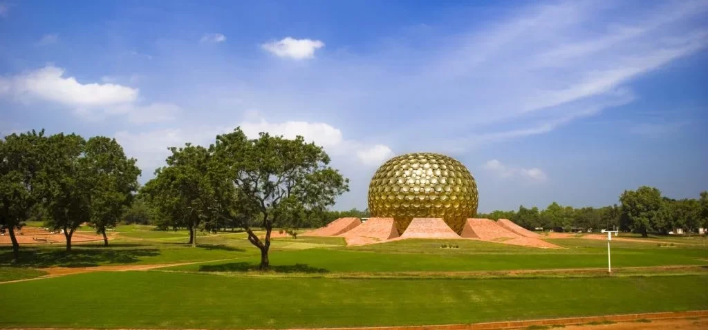
Spirituality is also integral to Pondicherry‘s identity, with several spiritual centers and ashrams dotting the landscape. The Sri Aurobindo Ashram and Auroville, an international township founded on principles of human unity and sustainable living, draw visitors seeking spiritual solace and enlightenment.
Pondicherry‘s rich history, vibrant culture, and serene ambiance make it a captivating destination for travelers seeking a unique blend of colonial charm, spiritual exploration, and coastal beauty.
Puducherry at a Glance
- Area: approximately 479 Sq. Kms.
- Districts: Comprised of 2 districts:
- Puducherry – comprises of Puducherry region and two geographically unconnected Administrative units of Mahe and Yanam,
- Karaikal.
- Location of the Districts: Puducherry district and Karaikal district lie within the territory of Tamil Nadu, while Yanam district and Mahe district are enclosed by the states of Andhra Pradesh and Kerala, respectively.
- Capital city: Puducherry.
- Coastline: The four regions of the Union Territory have a coastline of 45 km combined.
- Puducherry – 24 Km in Bay of Bengal.
- Mahe – 5 Km coastline in the Arabian Sea.
- Yanam –
- Karaikal –
- Emblem:
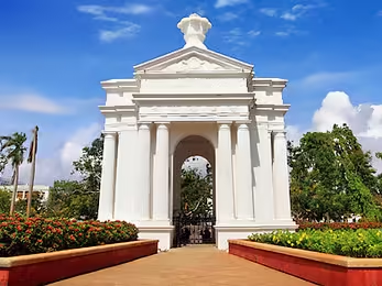
- Image of Aayi Mandapam.

- The Aayi Mandapam is a white monument situated in the heart of Bharathi Park in Puducherry.
- Other Names of Puducherry:
- ‘Quintessence of French Culture‘,
- ‘India’s Little France‘, and
- ‘The French Riviera of the East‘.
Brief History
- Arikamedu: An ancient marketplace called Arikamedu, mentioned in the Periplus of the Erythraean Sea (a 1st-century text) is located 3.2 km from the modern city of Puducherry.
- Trade with Roman Empire: The discovery of Roman pottery at Arikamedu in 1937 indicates that it was a significant destination for trade with the Roman Empire.
- French Settlement: In 1673, the French got a firman to build a trading center from the Sultan of Bijapur. In 1674, the French East India Company established a trading center at Pondicherry.
- First Governor: Francois Martin was the first Governor of Pondicherry.
- Treaty of Paris: After the Anglo-French wars (1742 to 1763), Pondicherry was captured by the British East India Company from the French but later returned to the French by the “Treaty of Paris” in 1763.
- After gaining control of the whole of India in the late 1850s, the British East India Company permitted the French to maintain their settlements within the country. Consequently, Pondicherry, Mahe, Yanam, Karaikal, and Chandernagar continued to be integral parts of French India until 1954. Puducherry were under the French rule for 138 years.
- Integration into India: Puducherry officially became an integral part of India in 1963.
Important Rivers
- Puducherry: Gingee River (Sankarabarani River)
- Source: Eastern Ghats, specifically near the Gingee town in the Villupuram district of Tamil Nadu.
- Mahe: Mayyazhi river,
- Yanam: Gauthami Godavari,
- Karaikal: Arasalar river.

