Table of Contents
This Article is being Updated

Introduction: West Bengal
West Bengal, located in the eastern part of India, is one of the country’s most culturally vibrant and historically significant states. With its capital at Kolkata (formerly Calcutta), it is renowned for its rich heritage, diverse culture, and socio-political dynamism.
West Bengal is the birthplace of renowned personalities such as Rabindranath Tagore, Satyajit Ray, and Subhas Chandra Bose, who have contributed significantly to India’s cultural and political legacy.
West Bengal’s political history is characterized by a vibrant democratic tradition and a strong presence of grassroots movements. The state has played a pivotal role in India’s struggle for independence, with Kolkata serving as a center of nationalist activities during the colonial era.
West Bengal at a Glance
| Formation (by bifurcation) | 15 August 1947 |
| Borders with other state | Jharkhand and Bihar in the west Sikkim in the north Odisha in south Assam in the east. |
| International Borders | Bangladesh in the east, Nepal and Bhutan in the north |
| Capital | Kolkata (7th largest city by population in India) From 1772 to 1911, Calcutta was the capital of British India. From 1912 to India’s Independence in 1947, it was the capital of the United Bengal. |
| Area | 88,752 km2 (13th) |
| Maximum Length | 623 km |
| Maximum Width | 320 km |
| Highest elevation | Sandakphu (3,636 m) |
| Population (2011) | 91,347,736 (4th) |
| Population Density | 1,029/km2 |
| Official Language | Bengali • English |
| Additional Official Language | Nepali, Urdu, Hindi, Odia, Santali, Punjabi, Kamtapuri, Rajbanshi, Kurmali, Kurukh, Telugu |
| Sex ratio (2011) | 950 |
| Forest | 11,879 sq. km. (13.38% of total geographic area) |
| World Heritage sites |
Symbols of West Bengal
- Song: Banglar Mati Banglar Jol (written by Rabindranath Thakur)
- Bird: White-throated kingfisher
- Fish: Ilish
- Flower: Night-flowering jasmine
- Fruit: Mango
- Mammal: Fishing cat
- Tree: Chhaatim tree
Geography of West Bengal
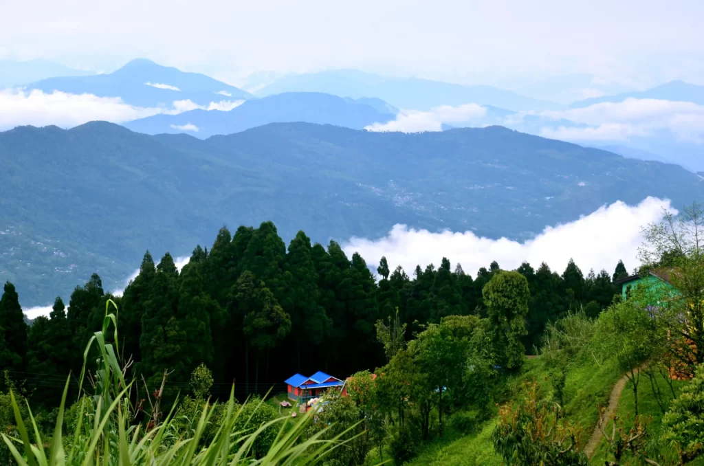
Darjeeling Himalayan hill region

- This region belongs to the Eastern Himalayan range.
- The Singalila Range is a north-south mountain ridge running from northwestern West Bengal that separates the mountain ranges of West Bengal from other Himalayan ranges to its west.
- It separates Nepal from West Bengal.
- Sandakfu (3,636 m), is the highest peak in the state. It is situated at the edge of the Singalila National Park in the Darjeeling district on the West Bengal – Sikkim – Nepal border.
- Other mountain peaks are Falut (3,600 m), Tonglu (3,036 m), and Sabargram (3,543 m).
Terai region
- It is the region that lies between the Sivalik Hills, and the Gangetic Plain.
- Teesta River divides the area into two parts: the Terai to the west and the Dooars (or Duars) to the east.
- This region is characterized by tall grasslands, scrub savanna, sal forests, and clay-rich swamps.
North Bengal plains
| District in this region | Southern parts of Jalpaiguri, North Dinajpur, South Dinajpur, Malda, Alipurduar, and the southern part of Coochbehar districts |
Rarh region
| Region | between the Chota Nagpur Plateau on the west and the Ganges River on the east |
| Average elevation | 75 and 150 meters |
| District in this region | Parts of the districts of Murshidabad, Birbhum, Bankura, Purba Bardhaman, Paschim Bardhaman, Purba Medinipur, and Paschim Medinipur. |
| The major rivers | Damodar (“Sorrow of Bengal“), Ajay, Mayurakshi, Dwarakeswar, Shilabati (Shilai) and Kangsabati River (Kasai) |
Coastal plain
| District in this region | A part of the district of Purba Medinipur along the Bay of Bengal. |
Western plateau and highlands
| District in this region | The western part of Purulia, Bankura, Birbhum, Bardhaman, and Paschim Medinipur |
Ganges delta
| District in this region | Nadia, Kolkata, North 24 Parganas, and South 24 Parganas districts, and the eastern part of Murshidabad district |
Important Rivers of West Bengal
| River | Source | Mouth | Tributaries |
|---|---|---|---|
| Mahananda River (360 km) | Paglajhora Falls, Darjeeling hills in the Himalayas | Ganges (in Bangladesh) | Mechi, Balason, Kalindi |
| Damodar River (592 km) | ChulhaPani, Chota Nagpur Plateau, Jharkhand | Hooghly River | Barakar, Sali |
| Teesta River (414 km) | Zemu Glacier (Sikkim) | Brahmaputra river (in Bangladesh) | Rangpo, Lachung, Rangeet |
| Jaldhaka River (233 km) | Bitang Lake, Sikkim | Brahmaputra river (in Bangladesh) | |
| Torsa River (358 km) | Chumbi Valley, Tibet | Brahmaputra River | |
| Kangsabati River | Chota Nagpur Plateau in Purulia |
